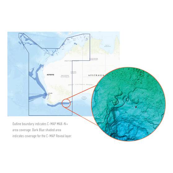
C-Map® Reveal: Darwin to Esperance Chart
Details
https://www.bcf.com.au/p/c-map-reveal-darwin-to-esperance-chart/599769.htmlPromotions
Additional Information
Product Info
Product Info
C-MAP® Reveal Charts give you a clearer picture of your surroundings so that you can make the most of your time on the water. Whether you're cruising around or spending the day with a fishing rod in hand, these high-resolution charts will help you navigate the water more safely. By providing a detailed view of the structures and contour changes on the seafloor, you'll also be able to find fishy spots that other fishos simply can't see. A key feature of these maps is the Shaded Relief setting which displays bottom contour in a way that looks like a 3D topographic chart on land giving you a clearer picture of and wrecks, structure, humps, or bumps down below.
Jam-packed with features including Custom Depth Shading, High Resolution Bathymetric Data, Genesis Layer, and Satellite Overlay, these charts give you a clear image of your surroundings. Having C-Map® Reveal on deck gives you 20/20 vision even when exploring new waters. All maps even feature detailed Marina Port Plans in addition to thousands of aerial photos of marinas, harbours, inlets, and other notable navigational features to give you a truckload of information that'll help you get around safely.
If you've got a Lowrance, Simrad, or B&G Chartplotter, adding a C-Map® Reveal Chart is a no-brainer.
Features
- Detailed charts from Darwin to Esperance
- Provides a 3D-like image of underwater contours and structure through the Shaded Relief function
- New features such as Custom Depth Shading, High Resolution Bathymetric Data, Genesis Layer, and Satellite Overlay combine to help you navigate your su
- Easily accessible tides and current data help you plan your day whether you're cruising or fishing
- Detailed Marina Port Plans and Harbour & Approach Details aid navigation and safe passage when boating in unfamiliar locations
- Find areas that other fishos might miss and easily mark these for your next fishing trip
- Aerial Photography provides an extra level of detail and enables you to understand your surroundings more easily
- Compatible with Lowrance, Simrad, and B&G Chartplotters


